
Download Meander – route planning, map measurement, and note‑taking tool
Overview
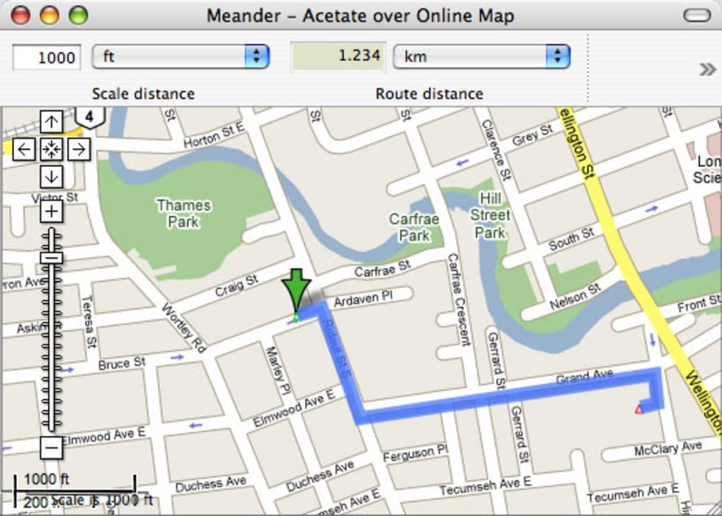
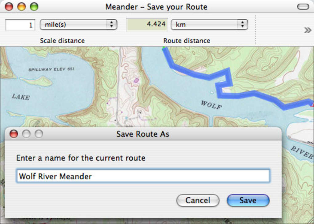
Meander was a niche geography software designed for Mac users who needed a lightweight way to plot routes, measure distances, and attach personal notes directly onto any map image. Although the program has been discontinued and can no longer be downloaded from the official site, it remains a reference point for hikers, field researchers, and anyone who prefers a visual journal over traditional paper maps. Meander let you import maps from the web, scanned documents, or local files, then overlay a transparent drawing canvas where you could add waypoints, distance markers, and free‑form annotations.
The core idea was to combine the precision of online mapping services with the flexibility of a personal sketchpad, all without the clutter of a full GIS suite. Users praised its intuitive drag‑and‑drop interface, the ability to export a combined map‑and‑notes PDF, and the straightforward distance‑calculation engine that automatically updated as you moved points. While it lacked advanced features like preset routes or built‑in map loading, its simplicity made it a favorite for short‑term planning, especially for weekend hikes or field trips where a quick visual summary was more valuable than a detailed topographic analysis.
Even though Meander is now unavailable, understanding its workflow helps you evaluate modern alternatives in the Mac > Geography Software category.
Key Features & Functionalities
- Map Import Flexibility: Load any raster image – satellite screenshots, scanned topographic maps, or PDFs – and use it as a base layer.
- Interactive Waypoints: Click to drop points, rename them, and assign custom icons for landmarks, water sources, or campsites.
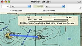
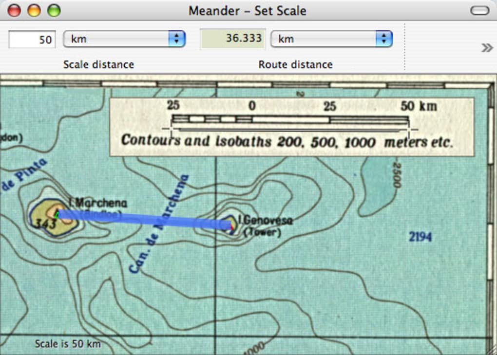
- Automatic Distance Measurement: The tool calculates linear distances between consecutive waypoints in miles or kilometers, updating in real time as you adjust points.
- Rich Text Annotations: Add multiline notes, colour‑coded tags, and even simple sketches to each waypoint for detailed observations.
- Export & Print Options: Generate a high‑resolution PDF that merges the original map with all annotations, ready for sharing or printing.
- Layer Management: Toggle visibility of notes, distance lines, or the original map to focus on specific aspects of your route.
- Simple Journal Integration: Keep a chronological log of observations directly within the map canvas, useful for post‑trip reporting.
These features made Meander especially attractive to outdoor enthusiasts who wanted a quick visual plan without diving into complex GIS software. The ability to annotate any map image meant you could work offline, a crucial advantage before the era of ubiquitous mobile data. While the lack of cloud sync limited collaboration, the export‑to‑PDF workflow allowed easy sharing via email or print. The distance engine, though basic, handled both straight‑line calculations and optional “follow‑the‑road” approximations when paired with a background road map. Overall, Meander’s feature set struck a balance between simplicity and enough power to satisfy most amateur route‑planning needs.
Installation, Usage Instructions & Compatibility
Even though Meander is discontinued, the last released version still runs on macOS 10.8 (Mountain Lion) through macOS 10.13 (High Sierra). The installer was a standard .dmg package that placed the application in the /Applications folder. To start using Meander, you had to launch the app and then manually drag the desired map image onto the Meander window – the program did not include a built‑in map browser. Below is a step‑by‑step guide that mirrors the original workflow, useful for anyone testing legacy copies or looking for a comparable process in modern alternatives:
Step‑by‑Step Installation
- Download the
Meander.dmgfile from a trusted archive (ensure the source is reputable to avoid malware). - Open the
.dmgand drag the Meander icon to the/Applicationsfolder. - Right‑click the app, select “Open,” and confirm you want to run an application from an unidentified developer (macOS Gatekeeper may block it by default).
- Once launched, you’ll see a blank canvas with a toolbar at the top.
Using Meander Effectively
- Import a Map: Drag a raster image (JPEG, PNG, or PDF) from Finder onto the Meander window. The image becomes the background layer.
- Add Waypoints: Click the “+” icon on the toolbar, then click on the map where you want a point. Double‑click the label to rename it.
- Measure Distances: After placing two or more points, Meander automatically draws a line and shows the distance. You can change units in the preferences (miles, kilometers, or meters).
- Annotate: Select a waypoint, then click the “Note” button to open a text box. Write observations, attach colour tags, or sketch simple arrows.
- Export: Choose File → Export → PDF. The resulting file merges the background map and all overlays into a single document.
Compatibility: macOS 10.8 – 10.13 (64‑bit). The application will not run on macOS 11 (Big Sur) or later without using a virtual machine or compatibility layer such as Wine. Because Meander never received updates for iOS, Android, or Windows, users looking for cross‑platform solutions should explore modern alternatives like MapMyHike or Google My Maps.
Although the installation process is straightforward, first‑time users often stumbled on the “no built‑in map loading” limitation. The workaround—drag‑and‑drop—requires a bit of preparation, especially if you rely on live web maps. Many reviewers suggested pairing Meander with a screenshot tool to capture the exact map view you need before importing. Despite this quirk, the learning curve remained shallow, and most users mastered the workflow within a single session.
Pros, Cons & Frequently Asked Questions
Pros
- Simple, drag‑and‑drop interface that requires minimal training.
- Works with any raster map, giving you total freedom over source material.
- Real‑time distance calculations in multiple units.
- Exportable PDF combines map and notes for easy sharing.
- Lightweight footprint – runs smoothly on older Macs.
Cons
- Discontinued; no official support or security updates.
- Incompatible with macOS versions newer than High Sierra without workarounds.
- No built‑in map browser – requires external screenshot or file preparation.
- Lacks preset route saving and cloud synchronization.
- Only available for macOS; no Windows, Linux, Android, or iOS versions.
FAQ
Can I still download Meander legally?
The official website no longer hosts the installer, but archived copies may be found on reputable software preservation sites. Always verify the source to avoid malicious software.
Is there a way to run Meander on macOS Big Sur or later?
Yes, you can use a virtual machine (e.g., Parallels Desktop) with an older macOS version, or run the app through Wine with appropriate configuration. Performance may vary.
How does Meander calculate distances?
The software uses the Euclidean distance between waypoints on the image, adjusted by a scale factor you define (e.g., pixels per mile). This method works best with maps that have a consistent scale.
Can I import GPS tracks into Meander?
Direct GPX import was not supported. Users typically exported GPS data as an image (e.g., a screenshot of the track) and then imported that image as a background layer.
What modern alternatives should I consider?
For Mac users, Maptitude, Google My Maps, and the open‑source QGIS provide richer feature sets. For cross‑platform needs, AllTrails and Komoot offer route planning, distance measurement, and cloud‑based note syncing.
Conclusion & Call to Action
Meander remains a compelling case study in how a minimalistic design can address a specific niche—adding notes and measuring routes on any map image—without the overhead of a full GIS platform. Its strength lay in the drag‑and‑drop workflow, real‑time distance calculations, and a clean export option that turned a scribbled map into a polished PDF. However, the software’s discontinuation, incompatibility with newer macOS releases, and absence of cloud features make it a less viable choice for today’s mobile, collaborative environment. If you already have a working copy of Meander on an older Mac, it can still serve as a handy offline tool for short hikes or field observations. For anyone starting fresh, we recommend exploring actively supported alternatives that retain Meander’s core simplicity while adding cross‑platform sync, GPS track import, and built‑in map sources.
Ready to upgrade your route‑planning workflow? Search the Mac App Store for “Geography Software” to discover modern successors, or visit our curated list of free and premium mapping tools. And if you still have a legacy Meander installation, give it a spin on a compatible Mac and experience the nostalgic charm of a classic map‑annotation app—just remember to back up your data and consider a migration path to a contemporary solution.